Your own private map
runningYour group on its own map, on our own servers, not a big tech company's. Every phone gets its own digital key, and everything it sends is encrypted.
Everyone in your group shows up as a dot on one private map, with group chat and an SOS button. If the cell towers go down, small radio tags keep the dots moving. We set it all up, run it on our own servers and teach your people to use it.
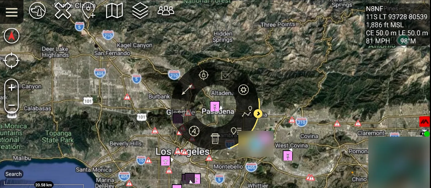
A drawing of what you'll see. You draw the fence on the map with your finger; the alert is built into the free map app, and we set it up with you.
Your people install one free map app on the phone they already own, Android or iPhone. Anyone without a phone, or going where there's no signal, clips on a tag the size of a matchbox.
Only your group sees your group. On the same map: chat, who's where, planes overhead, fires, earthquakes and traffic, each one on or off with a tap.
Someone presses SOS, a fire starts nearby, a tag goes quiet: the people who need to know get an alert with the spot on the map. And when you have a question, a person answers, not a bot.
Picture it. Your family is spread out at a packed stadium and the phones show full bars but nothing sends. Her tag and yours talk to each other by radio, so your map still shows her by Gate C, two sections over. You walk straight to her.
Every card below runs on our own servers right now. The label tells you honestly how far along each one is.
Your group on its own map, on our own servers, not a big tech company's. Every phone gets its own digital key, and everything it sends is encrypted.
Small waterproof tags talk to each other by radio, so a person shows up on the map with no cell service and no phone.
Ask it in plain words: "where's Dad?", "circle the campsite", "route me back to the truck". It answers and draws it on the map.
Live aircraft from our own receiver, wildfires, earthquakes, freeway incidents and traffic cameras, on the same map as your people.
We set up each phone with you and teach one tool at a time, outdoors, with a short drill. There's a free course to start on your own.
Car-grade millimeter-wave radar for people on the move and in the dark. No cameras. What we're building.
Gates, fences, water levels, weather, equipment that should stay put. If it can report, we can put it on your map. Examples.
The same system the military, firefighters and search teams use, set up and sized for you.
You don't need any of these to get started. But you'll hear them, so here's what they mean.
Andrew Bowen spent his career building power and communications where failure wasn't an option: military bases in Afghanistan and Iraq, U.S. embassies on four continents, microwave towers and fiber backbones. He builds this the same way: documented, tested, and boring on purpose.
Master electrician (retired) · FCC licensed radio operator KJ6YJR · FAA licensed drone pilot
Next up is sensing that works in the dark and through smoke, and camera-free fall detection for elder care. What we're building.
Tell me who you are, how many people, and what phones they use. I'll set up your private group, get every phone on the map with you, and run your first training session. See plans.
[email protected]Not ready yet? Take the free course and see if it fits.